Tide tables, tide prediction software, tide graphs, tide height finder, masses of tidal information
Home - Support - Downloads - Order - Contact us - Chart Plotter  About us

Order Tide Plotter online today from only £10.99
Download an evaluation copy.
Tidal streams
Screenshot gallery
Yachting Monthly "Instantly Impressed"
Sailing Today  
"5 stars" 
Read the press Reviews.
 See the additional features this year
Tide Plotter User Guide pdf
Email us


The complete package ready to plug in and go choose your pakage from the items below.
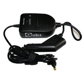
Ideal for when you are out and about. Use on boat, carry out all your planning, in the car, at home, at work. Light and portable. The ideal solution for the mobile boat navigator. All installed, ready to go. Options include: netbook, GPS, 12v and mains adaptors, chart plotting and tide plotter software complete with 800 large and small scale Admiralty Charts of the UK, Ireland and Channel. Has Wi-Fi facility for access to the internet. No worries about installing the GPS, configuring NMEA ports etc., and setting up the software. We do it all for you.

There are 6 different options to choose from click here to purchase 


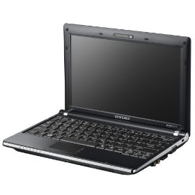
Samsung N130 10.1 inch Netbook (Atom N270 1.6GHz Processor, 1GB RAM, 160GB HDD, up to 6 Hour Battery Life , XP Home)

Operating System Genuine Microsoft Windows XP Home
Processor Intel Atom processor N270 (1.6GHz, 533MHz, 512KB, 2.5W
Memory Size1GB
Hard Drive Capacity160GB

Intel Atom processor
10.2" widescreen display is optimised to deliver a seamless visual experience Genuine Microsoft Windows XP Home. Normal-size, notebook PC style keyboard, for easy typing
Integrated 1.3 mega pixel digital motion camera. Even though it is one of the world's lightest 10.2" netbooks, weighing just 1.33kg with a 6 hr long life 6 cell battery, the N130 incorporates a stunning 10.2" WSVGA (1024 x 600) Superb Bright© Non-Gloss LED screen and normal-size, ergonomic notebook PC style keyboard that makes it even easier to type in comparison to other products of its kind.

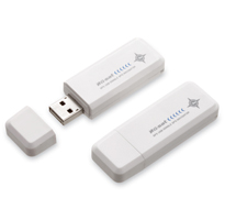
+ GPS for USB socket on computer

GLOBALSAT ND-100 USB GPS Dongle Receiver For NetBook,Laptop,Notebook,XP,Vista

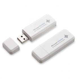
Plugs directly into your laptop, no external power needed. Quick and easy to use, waterproof, and will read signal from inside wood and fibreglass boats.

 USB GPS uses a modern SiRFSTAR III chipset, comes with a driver and is fully compatible with Microsoft XP, Vista adn Windows 7 . Provides NMEA 0183 signal.


+ adaptor for 12v socket (in addition to a mains adaptor) 


+
Chart Plotter

See more features
800+ Admiralty Raster Charts
    Routes, planning and monitoring  Waypoints, MOB   Tides: tidal graphs, tables and stream information.   Quick and easy scrolling and zooming to charts.     GPS and boat instrument input to display: position, heading, COG, SOG, XTE, depth, wind, water temp.    AIS: ships position, bearing, distance to, details. This requires input from an AIS receiver.   Logbook, entries can be made automatically and by user input.    Tracking of path  Marking chart areas, warning either entering or leaving user designated area, useful for anchor watch and passage planning   Bearing and direction lines, draw as you would on a paper chart to assist with navigational planning See the full detailed Manual containing all the features of the new Belfield Chart Plotter Click here

+
Tide Plotter
The complete Tide Plotter software with 3 years data, including graphs, tables and all of the Tide Plotter features see more screen shots


+ installed ready to go


Also available

GPS plus Chart Plotter software£99.95 plus £1.95 p&p


Charting package complete with a GPS which plugs directly into your laptop. Everything for your laptop to navigate you  around the UK and Ireland.

More navigation packages
click here