|
Tide Plotter now available. Download an
evaluation copy now to see
it in action.
Read what the
press have been saying about Tide Plotter on our reviews
page.
Purchase
Tide Plotter online for only £10.99
Find out exactly
what Tide Plotter can do by visiting our features
page.
What Ports are
included? Here is a complete list.
|
Unlike other tidal
prediction programs Tide Plotter is updated every year making sure
you benefit from the latest advances in technology and the use of
the latest Admiralty data. The following
additions and amendments have been made in Tide Plotter T
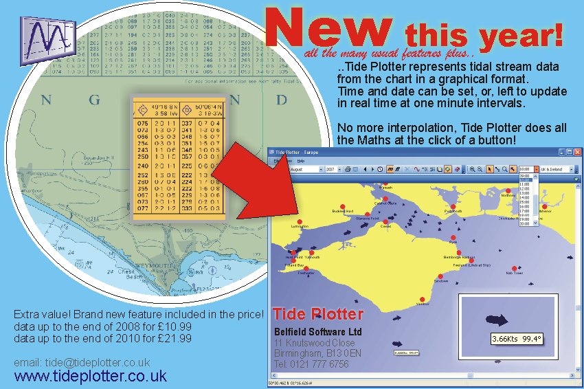
A new tidal streams
component included with no extra charge on the standard Tide
Plotter product. For the sea areas surrounding the UK and
Ireland, including the English Channel, we have presented tidal
stream information from the chart tidal diamonds.
This is presented in a
graphical format. Hover the cursor over the tidal stream arrow
and the direction and strength of stream is shown. The stream
information can be displayed either at a date and time
determined by yourself, or, Tide Plotter will continuously
update that information constantly in real time.
No more need for the
Maths of interpolation to make those calculations.
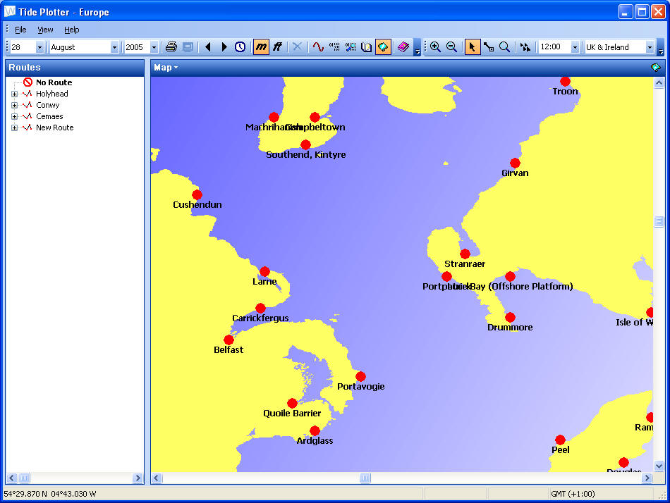
- New for 2007!! A
new interface for GPS to go with the screen with a scale map giving a point and click option to
find tide times and heights. There is a new facility that
enables data to be exported to a spreadsheet. These supplements
last year's features of a facility to draw
distances and bearings. There is also a tidal streams add on
which can be purchased at an additional cost of £33.95 per sea
area. This shows tidal streams for offshore passage making and
will work out tide vectors and course to steer and passage time.
- A version for Australia
- A
first with a version for the new generation of Smart Phones.
Download all 600 ports onto your mobile phone.
-
3 year version now
available
- A version with additional European ports.
Brest to Gibraltar and Northern Norway to Holland, plus of course
the bit in-between, UK and Ireland
-
An East coast of
America version, including the USA Canada, the Caribbean
and the Gulf of Mexico
-
Logbook - free, a logbook
in pdf format, contains useful information as well as allowing you
to record all your trips
-
Working with tides
- free, an electronic book giving both the theory of tides plus
practical examples for you to work through. Excellent if you are
following an examination syllabus etc
-
Photo gallery - a
new set of 200 high resolution photos and images
- Updated
manual explaining the wide variety of uses for Tide Plotter
- Additional ports added
- Latest data from the UK Hydrographic
Office. Making sure you benefit from the most recent surveys and
observations of
ports and harbours.
plus
the additional features in previous editions:
-
Height finder -
enter a tide height for your port and Tide Plotter produces a
table of times when the tide is predicted to be at that height
- Tide
Log - keep your own log of ports, dates HW & LW plus
enter your own time and get the tide prediction.
- Windows
CE Pocket PC version bundled with the PC version at no extra cost
- Sunrise and sunset times calculated for the
selected port and date.
- Moon phases shown on the monthly tide
tables.
- Much faster calculations of predictions.
- Export graphs to the popular JPEG format.
- Nearest ports. See at a glance the distance
and bearing to the nearest 10 ports.
- Improved support of time zones.
- View ports ordered by name or location.
- Much faster
- Put the cursor anywhere on the graph line
for a reading of the time and height of tide
- Enhanced help with a new manual now
available on the CD. Acrobat Reader version 6 is also available
to read the manual
|