Pay via a secure server, PayPal, credit or debit card
On this page:
Chart Plotter click here
Tide Plotter click here
GPS for laptop click here
Netbook navigation packages click here
Chart Plotter plus Tide Potter plus GPS for laptop
Chart Plotter plus GPS for laptop click here
Features
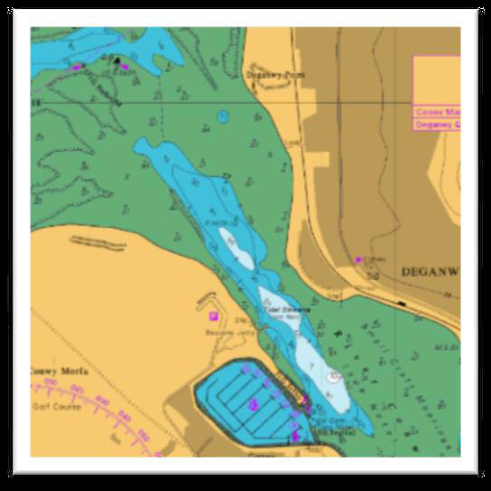
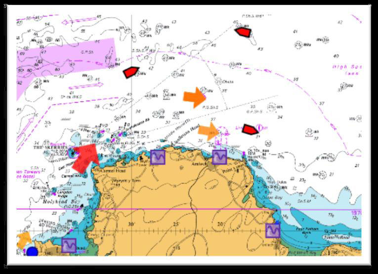
complete set of 800+
Admiralty Raster Charts for UK, Ireland and Channel. Routes,
planning and monitoring.
Waypoints, MOB.
Tides: tidal graphs, tables and stream information.
Quick and easy scrolling
and zooming to charts.
GPS and boat instrument input to
display: position, heading, COG, SOG, XTE, depth, wind, water
temp.
AIS: ships position, bearing, distance
to, details. This requires input from an AIS receiver.
Logbook, entries can be made
automatically and by user input. Tracking
of path. Marking chart areas,
warning either entering or leaving user designated area, useful for
anchor watch and passage planning. Bearing and
direction lines, draw as you would on a paper chart to assist
with navigational planning
download the
User Manual for full details. More information
click
here
Tide Plotter
 Purchase and download the program
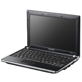
Netbook
navigation package
Operating System Genuine Microsoft Windows XP Home Netbook plus chart plotter plus 3 yr Europe Tide
Plotter plus ND-100 GPS plus 12v adaptor £399.95 All software
and GPS drivers are installed ready to go -
£399.95
courier delivery
£9.95
Chart Plotter plus GPS
ND-100 plus Tide Plotter
2012 £119.95
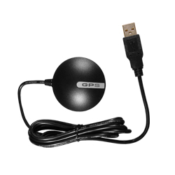
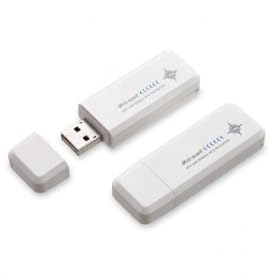
that works directly from your laptop and will pick up the GPS
signal inside wood and fibreglass boats. USB GPS uses a SiRFSTAR III chipset, WAAS/EGNOS
enabled
comes with
a driver and is fully compatible
with Microsoft XP, Vista and
Windows 7. So if
you've recently purchased a new
laptop this should be on top of your
new kit list, for only £39.95
plus £5.90 post and packaging.
 £399.95
includes netbook computer, plus options for chart & tide software, GPS & 12v
adaptor. All installed, ready to go.
Processor Intel Atom processor N270
(1.6GHz, 533MHz, 512KB, 2.5W
Memory Size1GB
Hard Drive Capacity160GB
more
details
Colour Black
will pick up the GPS signal inside
wood and fibreglass boats, the
software and hardware makes
your laptop into a working navigation station.
GPS
Chipset High sensitivity single chip solution 48 channel
all-in-view tracking
GPS Transfer Rate 38400 USB Protocol USB 2.0
chipset,WAAS/EGNOS
enabled
comes with
a driver and is fully compatible
with Microsoft XP, Vista and
Windows 7. Just plug the GPS
into the USB port on your laptop, this unit will work inside
fibreglass and wooden boats.
Chart Plotter plus GPS
ND-100 £99.95
will pick up the GPS signal inside
wood and fibreglass boats, the software and hardware to make
your laptop into a working navigation station.
GPS Chipset High sensitivity single chip
solution 48 channel all-in-view tracking GPS Transfer Rate 38400
USB Protocol USB 2.0
chipset,
WAAS/EGNOS
enabled comes with a driver and is fully compatible
with Microsoft XP, Vista and Windows 7. Just plug the GPS
into the USB port on your laptop, this unit will work inside
fibreglass and wooden boats.